
Latest 8 Panoramas
Tornmuseet
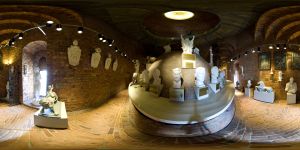
If you want to get up in the 106 meter high tower, there is an elevator to the fifth floor, but you can also walk the 365 steps.On the fifth floor you will find the tower museum(tornmuseet). Here, there are models and busts found in the town hall, as well as samples of gold mosaic of the Golden Hall.
Luleå, a town in the Swedish province of Norrbotten have a population of about 73000. It has been a market place for the area for a long time but the modern Luleå started growing when it became the harbour for shipping iron ore from nearly situated iron mines. The World Heritage church town, Gammelstad, which has been the original Luleå is about 10 km from the current Luleå town.
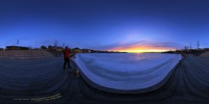
Sunset over Stadsviken in Luleå. Luleå, a town in the Swedish province of Norrbotten have a population of about 73000. It has been a market place for the area for a long time but the modern Luleå started to grow when it became the harbour for shipping iron ore from nearly situated iron mines. The World Heritage church town, Gammelstad, which has been the original Luleå is about 10 km from the current Luleå town.
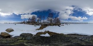
This is a camping by the Gulf of Bothnia to the north of Baltic Sea. Swedish nature at its best. There are thousands of people coming from all over Sweden and the world to stay at campings like this to enjoy the Swedish summer, fishing, relaxing in a green area with water all over the place. This place is near Kalix, somewhere between Luleå and the Finnish border. When this image was taken was end of April and the see was still frozen. It is off season and there are no tourists here yet. All cotages are empty but will be filled during the summer.
Stallgatan is a street in Blasieholmen, one of the islands that forms Stockholm, Sweden
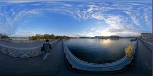
Skeppsholmsbron, Stockholm, Sweden. Den byggdes i mitten av 1800-talet och stod färdig 1861. Den består av fem, drygt trettio meter långa spann av valsat smidesjärn, vilket var en innovation vid den här tiden. Monogrammet på bilden är Karl XV:s, som var kung när bron byggdes.
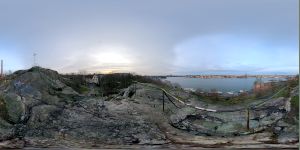
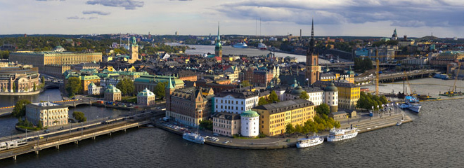
Skinnarviksberget, in the Stockholm district of Soedermalm is the highest natural point in the downtown with 53 m above sea level.
Skinnarviksberget offers a view over Riddarfjaerden, Norr Maelarstrand, Riddarholmen, Gamla Stan and a large part of the northern downtown.
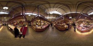
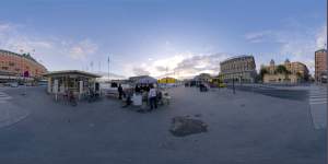
A place to buy and/or eat food since 1888.
There are twenty or so different stalls, restaurants, cafes and wine bars in this food hall/market in the heart of Stockholm.
|
|
|
|
|
|