
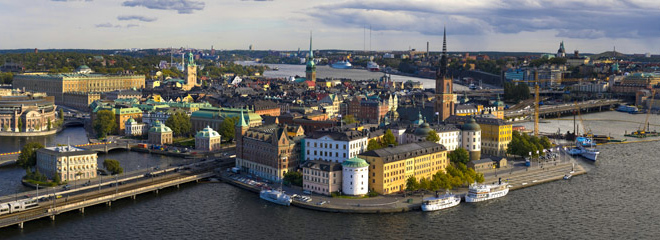
Latest 8 Panoramas
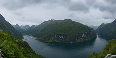
The Geirangerfjorden is a fjord in the Sunnmøre region of Møre og Romsdal county, Norway. It located entirely in Stranda Municipality. It is a 15-kilometre (9.3 mi) long branch off of the Sunnylvsfjorden, which is a branch off of the Storfjorden (Great Fjord).
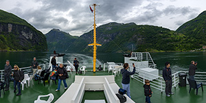
The fjord is one of Norway's most visited tourist sites. In 2005, it was listed as a UNESCO World Heritage Site, jointly with the Nærøyfjorden, although this status is now threatened by the disputed plans to build power lines across the fjord. A car ferry, which doubles as a sightseeing trip, is operated by Fjord1 Nordvestlandske. It runs lengthwise along the fjord between the small towns of Geiranger and Hellesylt.
The Geirangerfjord is known as the real jewel of the Norwegian fjords. With high waterfalls and abandoned mountain farms, the fjord landscape is included on the UNESCO World Heritage list. Here you find unspoilt and beautiful nature.
Ferry cruises take you on a journey through the area's dramatic scenery. Very steep mountains and wild waterfalls. Among the Geirangerfjord's nine most famous waterfalls are the Seven Sisters and the Bridal Veil.
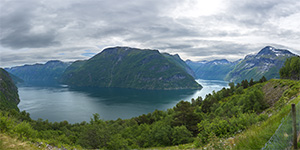
The Sunnylvsfjorden is a fjord in Stranda Municipality and Norddal Municipality in Møre og Romsdal county, Norway. The 26-kilometre (16 mi) long Sunnylvsfjorden is one of the innermost branches of the large Storfjorden. The fjord ranges from 600 to 2,000 metres (2,000 to 6,600 ft) wide and the fjord reaches 452 metres (1,483 ft) below sea level at its deepest point, just west of Skrenakken near the mouth of the fjord. The famous Geirangerfjorden branches off to the west from the Sunnylvsfjorden.
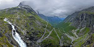
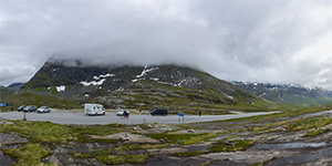
Trollstigen (English: Trolls' Path) is a serpentine mountain road in Rauma Municipality, Møre og Romsdal county, Norway. It is part of Norwegian National Road 63 that connects the town of Åndalsnes in Rauma and the village of Valldal in Norddal Municipality. It is a popular tourist attraction due to its steep incline of 10% and eleven hairpin bends up a steep mountainside. During the top tourist season, about 2,500 vehicles pass daily. During the 2012 season, 161,421 vehicles traversed the route, compared to 155,230 vehicles during 2009.
|
|
|
|
|
|